
The Portuguese Camino from Porto has 3 different routes. Each route is beautiful and offers a unique walking experience. The Litoral Way is the one that goes mostly (80%) along the coast past picturesque beaches and seaside towns. The Central Route is an inland route that takes pilgrims through the countryside, forests, and historical towns. You can experience the best of two worlds by combining the Litoral and Central routes.
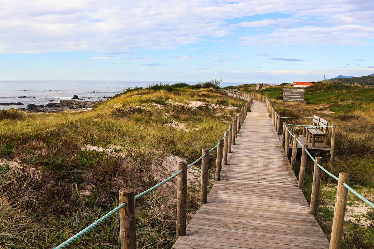
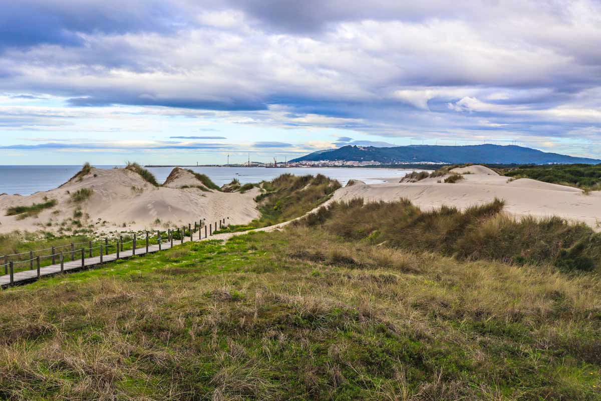
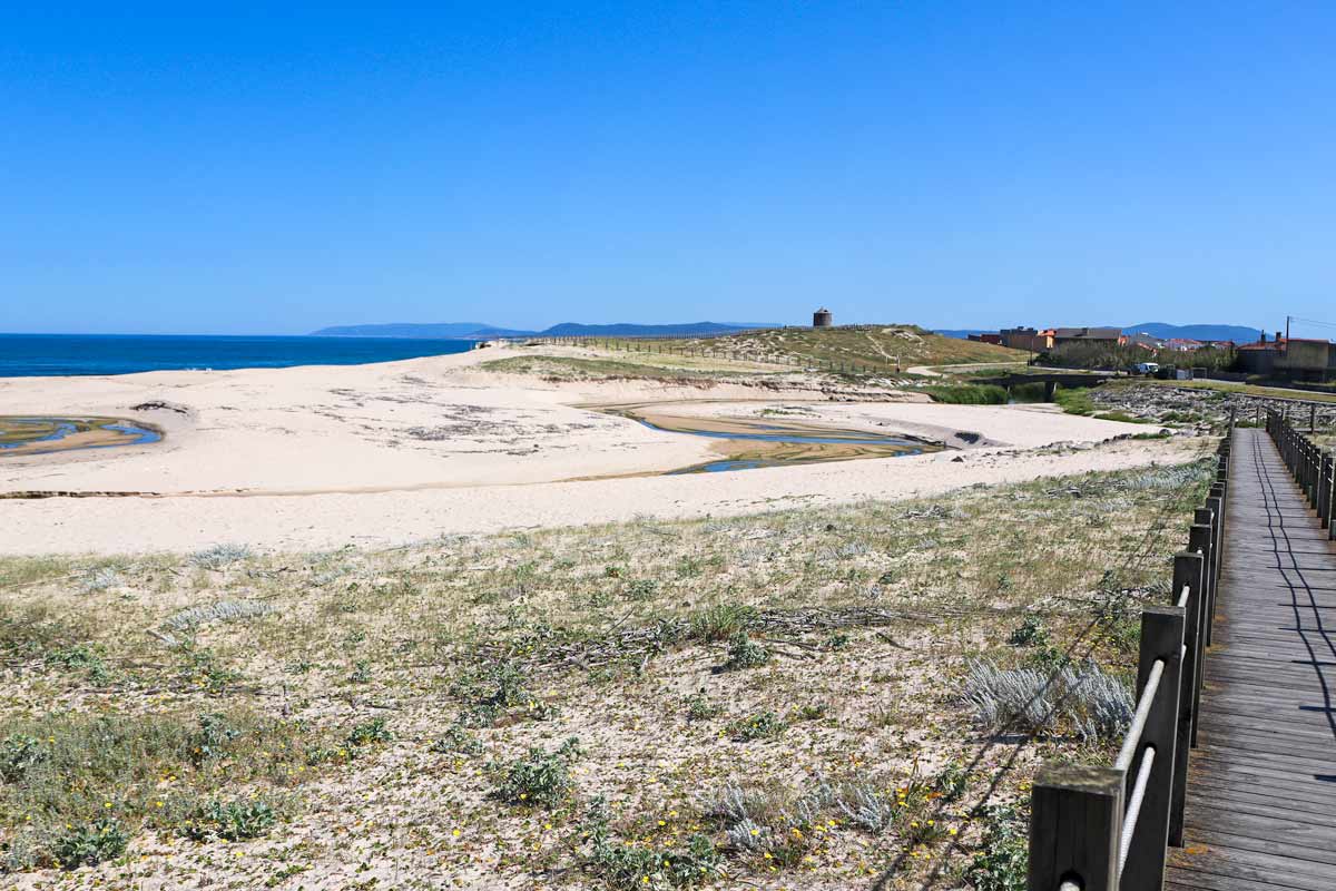
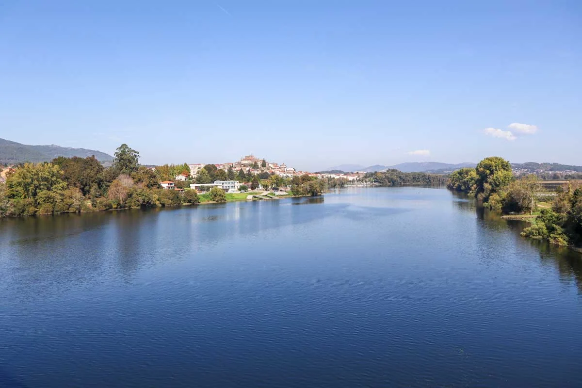
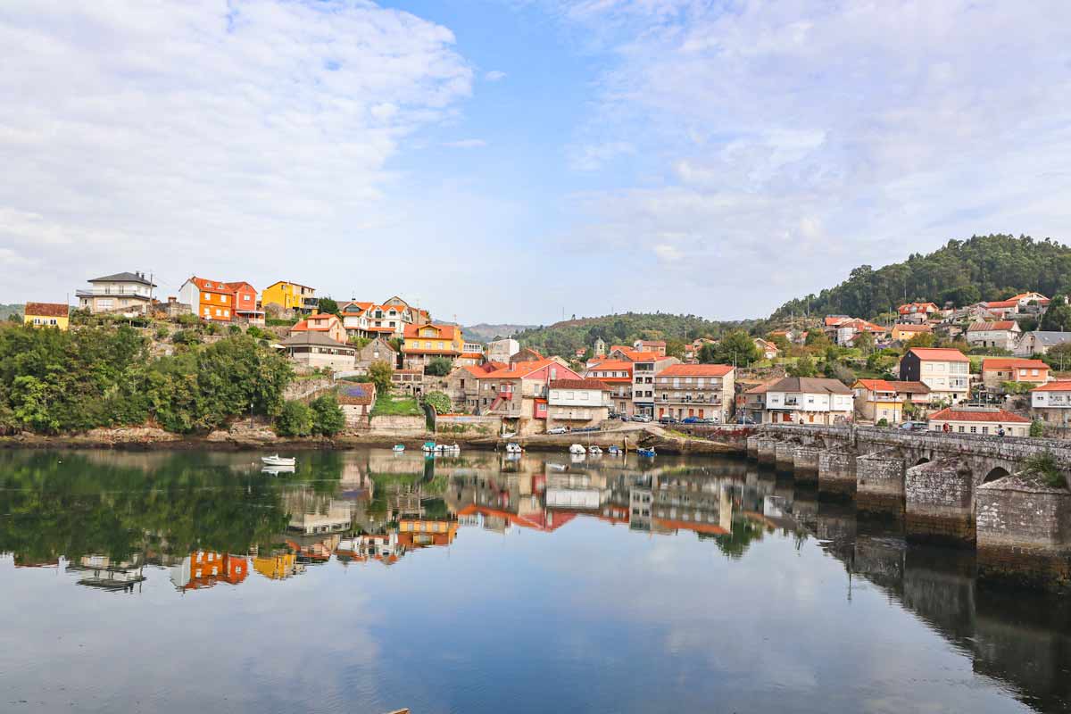
 The spectacular coastal scenery on the Litoral and Central routes combined
Table of Contents
Toggle
- Downloadable PDF of the combined route
- Google maps for navigation
- How to combine the Litoral and Central route?
- How long is this route?
- What are the advantages of combining the routes?
- What is the scenery like on the combined route?
- Add the Spiritual Variant to the route
- The combined route overview
- Walking stages of the Litoral and Central routes combined
- Stage 1. Se Cathedral, Porto to Aldeia Nova, 17 km/10.5 mi
- Stage 2. Aldeia Nova to Póvoa de Varzim, 22 km/13.6 mi
- Stage 3. Póvoa de Varzim to Esposende, 23 km/14.2 mi
- Stage 4. Esposende to Viana do Castelo, 25 km/15.5 mi
- Stage 5. Viana do Castelo to Vila Praia de Âncora, 19 km/11.8 mi
- Stage 6. Vila Praia de Âncora to Gondarém, 19 km/11.8 mi
- Stage 7. Gondarém to Valença, 20 km/12.4 mi
- Stage 8. Valença (Portugal) to Porriño (Spain), 20.5 km/12.7 mi
- Stage 9. Porriño to Cesantes, 18 km/11.1 mi
- Stage 10. Cesantes to Pontevedra, 18 km/11 mi
- Stage 11. Pontevedra to Caldas de Reis, 21 km/13 mi
- Stage 12. Caldas de Reis to Padron, 18.5 km/11.5 mi
- Stage 13. Padron to Santiago de Compostela, 25.5 km/15.8 mi
Downloadable PDF of the combined route
You can download our free PDF file that contains the walking stages of the Litoral/Central route and a list of accommodation options at the end of every stage.
Google maps for navigation
How to combine the Litoral and Central route?
There are two routes that connect the Litoral Way and the Central Route of the Portuguese Camino. The first one is from Vila do Conde to Sao Pedro de Rates (the 2nd stage). If you choose this option you walk out of Porto following the Litoral and on the second day you switch to the Central Route. It is a good option if you want to walk out of Porto following the more scenic route and continue on the Central Route.
The second connecting route is from Caminha to Valença, at the end of the Portuguese part of the Camino. It is the best option if you want to combine both routes. This way you walk half of the Portuguese Camino on the Litoral Way and half on the Central Route. You walk along the coast in Portugal and through the forest and countryside in Spain. In this post I describe in detail this route option.
How long is this route?
The total distance of the Litoral and Central routes combined is 262.5 km/163 mi. You will need around 14 days to complete the route walking the average of 20 km/12.4 mi per day.
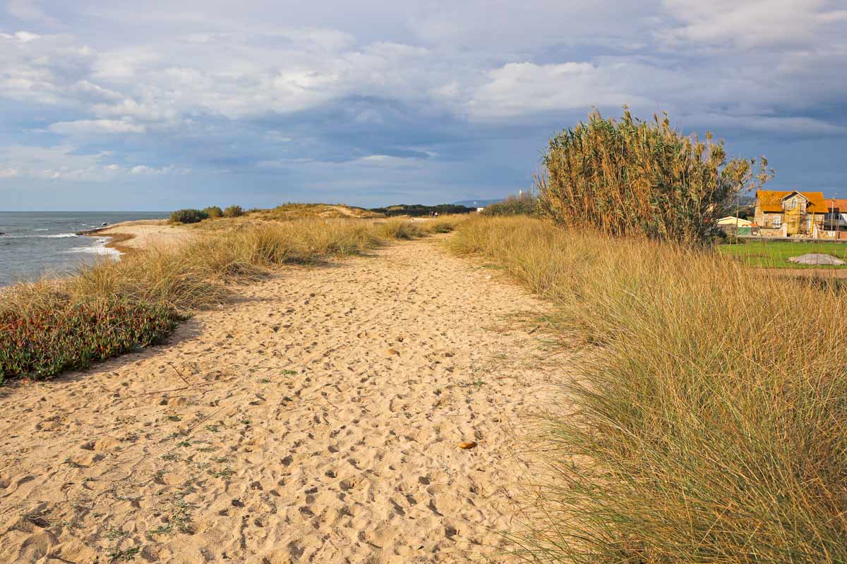
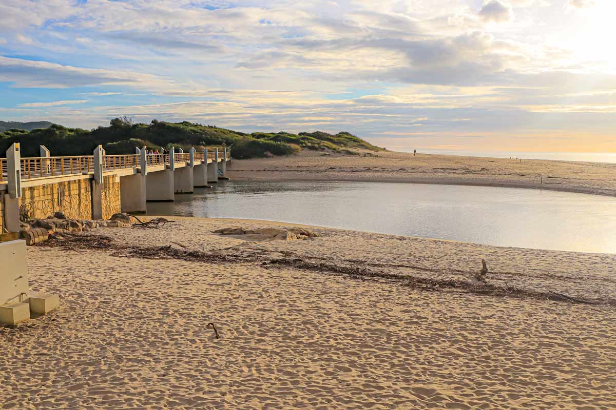 Sunset at the beach on Vila Praia de Ancora on the Litoral Way
What are the advantages of combining the routes?
The main advantage is that you get to see diverse landscapes; beaches, coast, forest, countryside, and interesting historical towns. You combine two Camino routes in one.
The second advantage is that walking this way you skip the least pleasant part of the Litoral Way (in my opinion, some people might not agree with me) walking to and out of Vigo. Don’t get me wrong, the historical center of Vigo is beautiful but it is a big port city with busy roads. You walk for 2-3 km through the outskirts, industrial areas, and next to the roads with a lot of traffic. Plus, the route marking is basically non-existent in the city.
Another good thing about combining the Litoral and Central routes is that you walk very little on the famous “calçada Portuguesa” cobbled stones which is tougher on your feet especially if you walk long distances. Cobbled roads are very common in Portugal, in some parts of the Central route even roads through the forest are cobbled. On the Litoral Way you walk a lot on boardwalks. In the Spanish part of the route you almost never walk on cobbled stones.
 The sanctuary of our Lady of the Agony in Viana do Castelo
What is the scenery like on the combined route?
From Porto to Caminha on the Litoral Way you get to walk 80% by the sea which means you see many sandy beaches, small bays, spectacular coastline, and charming seaside towns. You walk a lot on boardwalks and promenades.
On the connecting route from Caminha to Valença you walk partially along the Minho River and through the forest and countryside.
From Valença you continue on the Central Route to Santiago de Compostela. In this part you walk through the picturesque Galician forest, historical towns, and countryside.
As you can see the combined route offers a great variety of scenery.
Add the Spiritual Variant to the route
If you want to add to all mentioned above a scenic boat ride which is an official part of the Camino route you can combine it with the Spiritual Variant (Variante Espiritual). The Spiritual Variant is an optional route of the Portuguese Camino which splits from the Central Route after Pontevedra and merges with it again in Pontecesures. This 3-day route consists of two walking days and a boat ride.
You can download our PDF file of the Litoral + Central route combined with the Spiritual Variant.
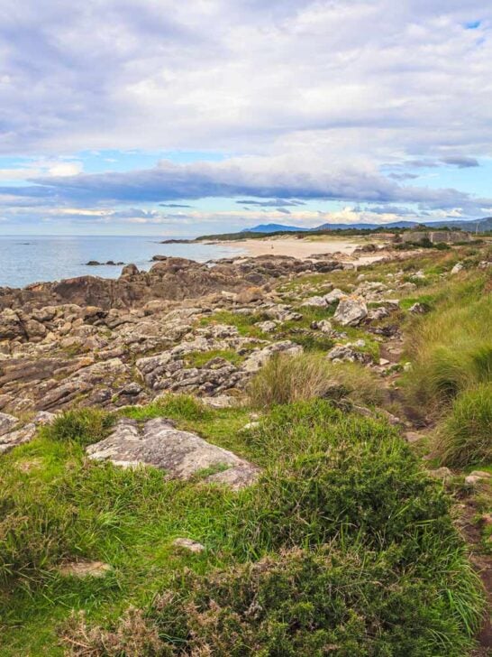
 Fantastic coastal scenery on the Litoral Way from Porto to Caminha
The combined route overview
- Distance – 262.5 km/163 mi
- Number of days (stages) – 12-15
- Starting point – Sé Cathedral, Porto, Portugal
- Finishing point – Santiago de Compostela Cathedral, Spain
- Difficulty level – moderate
- Accumulated ascent – 3118 m
- Accumulated descent – 2797 m
- Walking surface – 161 km/100 mi – asphalt/tar; 50.5 km/31.3 mi – footpath/gravel road; 31 km/19.2 – boardwalk; 16 km/10 mi – cobblestones; 4 km/2.4 mi – sand/beach.
- Average cost – 25-30 euros per day per person (staying in albergues), from 40 euros per day per person (staying in hotels).
- Walking along the coast – 79 km/49 mi
Walking stages of the Litoral and Central routes combined
Stage 1. Se Cathedral, Porto to Aldeia Nova, 17 km/10.5 mi
- Distance – 17 km/10.5 mi
- Time – 4 hours (moving time)
- Ascent – 200 m
- Descent – 220 m
- Walking surface – 2 km/1.2 mi – boardwalk; 14 km/8.6 mi – tar road; 1 km/0.6 mi – cobbled
- Walking along the coast – 4 km/2.4 mi + 10 km/6.2 mi – along the Douro River
It’s a beautiful walking day first along the Douro River from the Cathedral and then along the coast and past several beaches. The first 10 km/6.2 mi mi from Se Cathedral are not marked. The easiest is to get down to the river and walk north following it. Once you’re in Matosinhos you will start seeing traditional Camino signs; yellow arrows and shells.
Highlights
- Se Cathedral and the historical center of Porto
- Walking along the Douro River
- Walking along beautiful beaches
- Farol de Leça, a high lighthouse with the museum
- Boardwalk along the coast
Challenges
- The first 10 km/6.2 mi from the Cathedral are not marked. It’s not difficult to find the route; you follow the Douro River for 10 km/6.2 mi till you get to the information office in Matosinhos. From there you can follow the yellow arrows.
Route description stage 1
0-6 km/0-3.7 mi – Through Porto, along the Douro River, restaurants and cafes.
You can skip the first 6 km by taking a tram #1 or #18 from the Cathedral to Passeio Alegre.
6 km/3.7 mi – Foz de Douro. São João Baptista Fortress and Barra do Douro Lighthouse.
10.5 km/6.5 mi – Matosinhos. Information office You can get a stamp and find out where to buy a Credential. The first official Camino sign since the Cathedral. Soon after the route turns inland and goes through the town.
10.5-13 km/6.5-8 mi – through Matosinhos. Restaurants, shops, cafes, ATMs.
13 km/8 mi – another tourism information office. You can get another stamp.
13 km/8 mi – Leça da Palmeira, a town with hotels, restaurants, bars, and shops. The Litoral Way is back to the coast.
13-17 km/8-10.5 mi – along the coast past several cafes and restaurants. Some might be closed in winter.
15-17 km/9.3-10.5 mi – on the boardwalk.
17 km/10.5 mi – Aldeia Nova, a small town with guesthouses, restaurants, and a bar.
Places to stay in Aldeia Nova
 A beautiful promenade on the Litoral Way from Porto
Stage 2. Aldeia Nova to Póvoa de Varzim, 22 km/13.6 mi
- Distance – 22 km/13.6 mi
- Time – 5-6 hours (moving time)
- Ascent – 80 m
- Descent – 72 m
- Walking surface – 14 km/8.6 mi – boardwalk; 4 km/2.4 mi – tar road; 4 km/2.4 mi – cobbled
- Walking along the coast – 15 km/9.3 mi
A nice walking day mostly along the coast with spectacular views. If you walk in summer you can stop at one of the many beaches along the route for a quick swim. The route is mostly marked except the part through Vila do Conde where after crossing the bridge you follow the river back to the coast. There will be plenty of places to stop for lunch and coffee along the route.
Highlights
- Spectacular coastal scenery and beaches
- The river walk in Vila do Conde
- The promenade between Vila do Conde and Póvoa de Varzim
Challenges
- It’s an easy and flat walking day with many places to stop for coffee or food.
Route description stage 2
0-15 km/0-9.3 mi – along the coast on the boardwalk.
3 km/1.8 mi – Agudela, a small place with a big supermarket, 400 m away from the Camino.
6 km/3.7 mi – Praia de Angeiras, a small place with Orbitur Campsite, and guesthouses.
7 km/4.3 mi – Labruge, a small town with a Municipal Albergue (900 m away from the route, inland), guesthouses, cafes, and restaurants.
9 km/5.5 mi – Vila Chã, a small town with a Municipal Albergue (800 m from the Camino, inland), guesthouses, a campsite, cafes, and restaurants.
11.5 km/7.1 mi – Praia de Mindelo, a small place with hotels, restaurants, and a shop.
13.8 km/8.5 mi – Praia do Árvore, another small place with hotels, restaurants, cafes, and a shop.
14.5 km/9 mi – Praia da Azurara with a guesthouse, and cafes.
15-20 km/ 9.3-12.4 mi – the Camino goes inland.
16.5 km/10.2 mi – Vila do Conde, a big town with a Municipal Albergue, hostels, hotels, restaurants, cafes, supermarkets, ATMs, and pharmacies.
16.5-18 km/10.2-11 mi – along the river in Vila do Conde.
18.3 km/11.3 mi – the Fortress of São João Baptista.
18-22 km/11-13.6 mi – on the promenade along the beach, cafes and restaurants.
22 km/13.6 mi – Póvoa de Varzim, a big town with a Municipal Albergue, MA, hostels, hotels, restaurants, shops, ATMs, and pharmacies.
Places to stay in Póvoa de Varzim
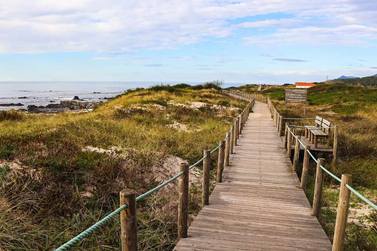
 Spectacular walk on boardwalks along the coast on the Litoral Way from Porto to Vila do Conde
Stage 3. Póvoa de Varzim to Esposende, 23 km/14.2 mi
- Distance – 23 km/14.2 mi
- Time – 5-6 hours (moving time)
- Ascent – 102 m
- Descent – 91 m
- Walking surface – 7.5 km/4.6 mi – boardwalk; 11.5 km/7.1 mi – tar road; 3 km/1.8 mi – cobbled; 1 km/0.6 mi – footpath/gravel road
- Walking along the coast – 17 km/10.5 mi
Another stunning walking day on the Litoral Way mostly by the sea. Today you will walk past small coastal towns, old windmills, and picturesque beaches.
Highlights
- The walk along the coast from Povoa de Varzim to Aguçadoura
- Walking on boardwalks along the beach for 4 km/2.4 mi from Aguçadoura
- A boardwalk over the dunes with old windmills in Apulia
- Esposende promenade and beach
Challenges
- An easy and flat walking day mostly along the coast
Route description stage 3
1 km/0.6 mi – the Litoral Way and Coastal Route merge.
2-11 km/ 1.2-6.8 mi – along the coast.
3 km/1.8 mi – O Ver a Mar, a small town with a hostel, hotels, restaurants, and cafes.
7 km/4.3 mi – Aguçadoura, a small town with a Municipal Albergue, guesthouses, a shop, a restaurant, and a bar.
11 km/6.8 mi – a bar.
14 km/8.6 mi – the Litoral Way and Coastal Route split.
15.5 km/9.6 mi – a restaurant.
17.2 km/10.6 mi – Apulia, a small town with a private Albergue, hotels, restaurants, cafes, shops, a pharmacy, and a nice beach.
18 km/11 mi – Fão, a small place with hostels, guesthouses, restaurants, cafes, and shops.
19 km/11.8 mi – a campsite, and a restaurant.
20 km/12.4 mi – the bridge over the Cavado River. The Litoral Way and Coastal Route merge.
20.5 km/12.7 mi – a rest stop.
20.8 km/12.9 mi – a private Albergue and a restaurant.
21.4 km/13.2 mi – the Litoral Way and Coastal Route split.
23 km/14.2 mi – Esposende, a big beach town with hostels, hotels, restaurants, bars, supermarkets, ATMs, and pharmacies.
Places to stay in Esposende
 Breathtaking scenery on the route from Povo de Varzim to Esposende
Stage 4. Esposende to Viana do Castelo, 25 km/15.5 mi
- Distance – 25 km/15,5 mi
- Time – 6 hours (moving time)
- Ascent – 202 m
- Descent – 200 m
- Walking surface – 4 km/2,4 – boardwalk; 5,5 km/3,4 mi – tar road; 6,5 km/4 mi – cobbled; 7 km/4,3 mi – footpath/gravel road; 2 km/1,2 mi – sand/rocks
- Walking along the coast – 13 km/8 mi out of 25 km/15,5 mi
This stage of the route I called the “wild stage” because the first half of it from Esposende goes on the rocky beach, sand, and unclear footpath through the fields. It’s not dangerous or difficult just might feel a bit strange for those who used to follow a marked route. For this stage I strongly recommend using our GPX files of Google.maps provided in this post. If you’re worried about finding the route and rather walk on a well-marked trail you can do this stage on the Coastal Route.
Highlights
- São João Baptista Fort and the beach in Esposende
- A beautiful walk on a boardwalk/footpath along the coast through the forest between 1,5 km/0,9 mi and 4 km/2,4 mi
- Unspoiled rocky beach with dunes between 4 km/2,4 mi and 6 km/3,7 mi
- A scenic walk on the boardwalk between 17 km/10,5 mi and 18 km/11 mi
- The historical center of Viana do Castelo
Challenges
- Difficult to find the way without using the navigation
- Walking on sand between 4 km/2,4 mi and 6 km/3,7 mi
- A couple of ascents in the middle part (inland) of the stage
- Walking on a footpath hidden in the bush at 17,8 km/11 mi (the walk is fine but the beginning of the footpath is difficult to find).
Route description stage 4
0-1.7 km/0-1 mi – along the promenade in Esposende.
1.7 km/1 mi – a restaurant. The Litoral and Coastal routes split.
1.7-4 km/1-2.4 mi – on a boardwalk along the beach.
4 km/2.4 mi – the end of the boardwalk, the route continues along the beach.
5-8.5 km/3.1-5.2 mi – on a sandy footpath along the coast.
8.5 km/5.2 mi – the Litoral Way turns inland.
9 km/5.6 mi – a campsite.
11 km/6.8 mi – a bridge across a small picturesque river with a waterfall. Both routes merge before the bridge and split after it.
16 km/10 mi – the Litoral Way is back by the sea.
16.5 km/10.2 mi – Amorosa, a small coastal town with hotels, restaurants, cafes, and shops.
17-18 km/10.5-11 mi – on a boardwalk along the beach.
18-20 km/11-12.4 mi – on a footpath through the bush.
20 km/12.4 mi – the Camino turns inland.
21 km/13 mi – a campsite.
23.5 km/14.6 mi – the Eiffel Bridge across the river to Viana do Castelo. The Litoral and Coastal routes merge.
24.5 km/15.2 mi – the routes split after the bridge.
25 km/15.5 mi – Viana do Castelo, a big place with a Municipal Albergue, private Albergues, hotels, restaurants, bars, supermarkets, ATMs, and pharmacies.
Places to stay in Viana do Castelo
 The wild and beautiful part of the route from Esposende to Viana do Castelo along an untouched coast
Stage 5. Viana do Castelo to Vila Praia de Âncora, 19 km/11.8 mi
- Distance – 19 km/11.8 mi
- Time – 5 hours (moving time)
- Ascent – 105 m
- Descent – 97 m
- Walking surface – 3.5 km/2.1 mi – boardwalk; 9 km/5.5 mi – tar road; 1.5 km/0.9 mi – cobbled; 5 km/3.1 mi – footpath/gravel road
- Walking along the coast – 14 km/8.6 mi
Today’s walk is very beautiful and peaceful mostly along the coast with occasional countryside.
Highlights
- Sanctuary of our Lady of the Agony in Viana do Castelo
- A stunning walk along the coast past several beaches for 14 km/8.6 mi
- Several old windmills on the beach and in the forest
- An unspoiled beach Praia do Paco with big boulders
- The walk along the coast to Vila Praia de Ancora
Challenges
- An easy and beautiful walking day mostly along the coast.
Route description stage 5
0-2.5 km/0-1.5 mi – along the river in Viana do Castelo.
1.4 km/0.8 mi – Santiago da Barra Fortress.
1.8 km/1.1 mi – the Sanctuary of our Lady of the Agony.
2.5 km/1.5 mi – a hotel.
2.5-11.5 km/1.5-7 mi – walking along the coast.
3-3.5 km/ 1.8-2 mi – a promenade with restaurants.
9 km/5.6 mi – a cafe.
10 km/6.2 mi – two old windmills.
11 km/6.8 mi – the beautiful Praia de Paco Beach.
11.5-14 km/7.1-8.6 mi – the Litoral Way goes inland.
14-24 km/8.6-15 mi – the route goes along the coast.
19 km/11.8 mi – Vila Praia de Âncora, a beautiful coastal town with hostels, hotels, restaurants, bars, supermarkets, ATMs, pharmacies, a long promenade and a sandy beach.
Places to stay in Vila Praia de Âncora
 Breathtaking scenery on the Litoral Way from Viana do Castelo
Stage 6. Vila Praia de Âncora to Gondarém, 19 km/11.8 mi
- Distance – 19 km/11.8 mi
- Time – 5 hours (moving time)
- Ascent – 270 m
- Descent – 225 m
- Walking surface – 17 km/10.5 mi – tar road; 2 km/1.2 mi – footpath/gravel road
- Walking along the coast – 6 km/3.7 mi
- Walking on the road – 1.5 km/1 mi
Today you switch from the Litoral Way to the Central Route using the connecting route between Caminha and Valença. Once you are off the Litoral Way the route will have more hills. Especially on some stages of the Central Route.
Highlights
- A spectacular coastal walk from Praia de Ancora to Moledo
- The historical center of Caminha
- Many beautiful traditional Portuguese churches and chapels. I think I saw more than 10 of them on the way from Caminha to Valença. Every town or village along the route has one.
- A beautiful forest walk between 16 km/10 mi – and 18 km/11 mi.
Challenges
- Several short ascents and descents on the route through the forest
Route description stage 6
0-5 km/0-3.1 mi – walking along the coast.
5 km/3.1 mi – Moledo, a small town with a hostel, guesthouses, restaurants, cafes, shops, ATMs, and a beach.
6-8 km/3.7-5 mi – a long stretch on a sidewalk along the road.
9 km/5.5 mi – Caminha, a big town with a Municipal Albergue, private Albergues, hotels, restaurants, cafes, supermarkets, ATMs, and pharmacies.
12 km/7.4 mi – Seixas, a small place with a private Albergue, hotels, cafes, a shop, and a pharmacy.
16-18 km/10-11 mi – on a footpath through the forest.
19 km/11.8 mi – Gondarem, a small place with a couple of hotels and restaurants.
Places to stay in Gondarem
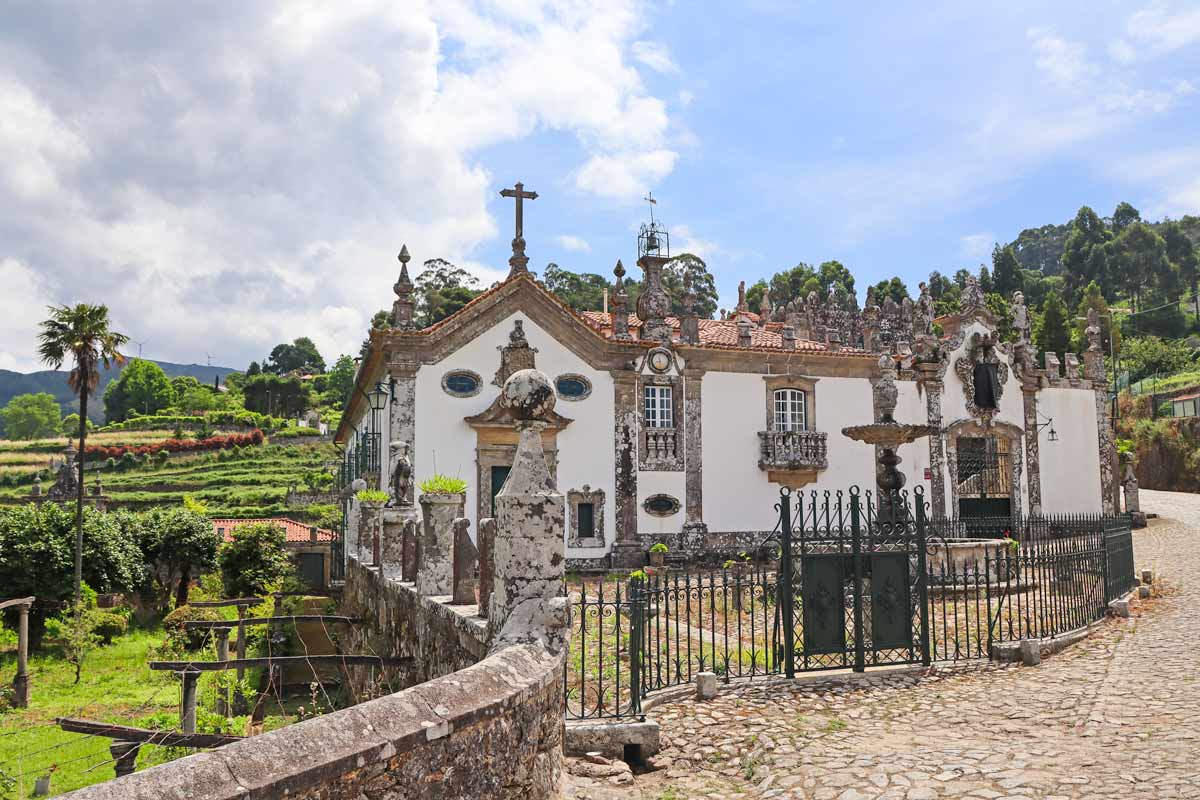 One of the many beautiful Portuguese churches on the connecting route from Caminha
Stage 7. Gondarém to Valença, 20 km/12.4 mi
- Distance – 20 km/12.4 mi
- Time – 5 hours (moving time)
- Ascent – 204 m
- Descent – 180 m
- Walking surface – 18 km/11 mi – tar road; 2 km/1.2 mi – footpath/gravel road
Today you will reachValença, the last Portuguese town on the Central Route. From there you will walk across the bridge to Spain. The fortress of Valença is quite impressive. It offers stunning views of the surrounding area. If you don’t have time to explore or simply too tired don’t worry, the Camino goes through the fortress so you will get a chance to see it the next day.
Highlights
- The historical center of Vila Nova de Cerveira.
- Valença Fortress and Old Town.
Challenges
- Several short ascents and descents in the first half of the route.
Route description stage 7
0-5.5 km/0-3.1 mi – through villages and forest.
1.5 km/0.9 mi – hotel Boega.
5 km/3.1 mi – Vila Nova de Cerveira, a small town with hotels, restaurants, cafes, shops, ATMs, and a pharmacy.
5.5 km/3.4 mi – hotels.
12 km/7.4 mi – a guesthouse.
14.5 km/9 mi – São Pedro da Torre, a small town with hotels, restaurants, and a shop.
18.5 km/11.4 mi – Valença outskirts; cafes, hotels, shops, and pharmacies.
19.5 km/12.1 mi – Valença historical center with a Municipal Albergue, a private Albergue, hotels, restaurants, cafes, shops, ATMs, and pharmacies.
Places to stay in Valença
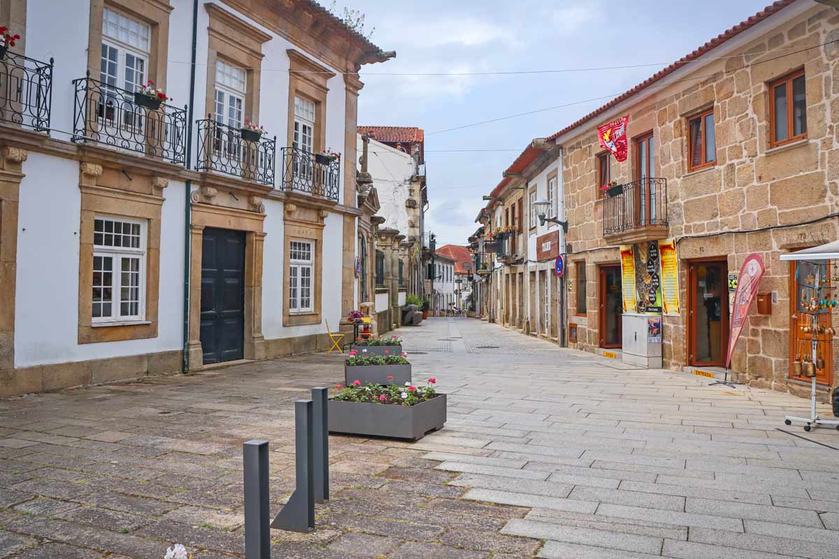 A charming street in the historical center of Vila Nova de Cerveira
Stage 8. Valença (Portugal) to Porriño (Spain), 20.5 km/12.7 mi
- Distance – 20.5 km/12.7 mi
- Time – 5 hours (moving time)
- Ascent – 192 m
- Descent – 204 m
- Walking surface – 17.5 km/10.8 mi – tar road; 3 km/1.8 mi – footpath/gravel road
- Walking on the road – 2 km/1.2 mi
Once you start walking from Valença on the Central Route so expect to see a lot more pilgrims especially from Tui, the Spanish town across the bridge from Valença. Tui is the place where many pilgrims who walk the last 100 km of the Portuguese Camino start.
Highlights
- Walking through Valença Fortress.
- Walking across the bridge from Portugal to Spain.
- The historical center of Tui.
- A beautiful forest walk after Tui.
Challenges
- A change of time after crossing the bridge between Portugal and Spain. Spain is 1 hour ahead of Portugal.
- If you don’t take an optional forest route at 14.5 km/9 mi you will walk through a large industrial area. So take the optional route (the left route) that goes along the river.
Route description stage 8
1-2 km/0.6-1.2 mi – Valença Fortress with many hotels, restaurants, bars, and shops inside the walls.
3 km/1.8 mi – the metal bridge over the Minho River; a crossing from Portugal to Spain. Don’t forget about the time change, Spain is 1 hour ahead of Portugal.
5 km/3.1 mi – Tui (Spain), a biggish town with a Municipal Albergue, private Albergues, hostels, hotels, supermarkets, restaurants, bars, ATMs, and pharmacies. You can stamp your Credential at the Cathedral in Tui, it’s on the Camino route.
12 km/7.4 mi – Ribadelouru, a small place with a guesthouse and cafe.
13.7 km/8.5 mi – a route split. Take the alternative route which goes through the countryside, the main route goes through a large industrial area. The distance on both routes is the same. I couldn’t take the alternative route because it was closed due to road works.
14.2 km/8.2 mi – Albergue Casa Alternativo, on the main route just after the split.
14.5-18.5 km/ 9-11.4 mi – on the main route, a large industrial area. On the alternative route – a quiet countryside.
18.5 km/11.4 mi – on the main route – a restaurant.
18.5-20.5 km/11.4-12.7 mi – on the main route – walking next to a busy road.
19.5 km/12.1 mi – on the main route – a restaurant and a bar.
20.5 km/12.7 mi – Porriño, a town with a Municipal Albergue, private Albergues, hotels, restaurants, cafes, supermarkets, ATMs, and pharmacies.
Places to stay in Porriño

 The view of Tui Fortress from the metal bridge over the Minho River
Stage 9. Porriño to Cesantes, 18 km/11.1 mi
- Distance – 18 km/11.1 mi
- Time – 5 hours (moving time)
- Ascent – 283 m
- Descent – 305 m
- Walking surface – 16.5 km/10.3 mi – tar road; 1.5 km/0.9 mi – footpath/gravel road
A nice and challenging walking day due to a steel and long ascent with a subsequent descent in the second half of the day walking through the forest. As you see the Central Route has got a lot more hills than the Litoral Way which is pretty much flat.
Highlights
- The picturesque town of Mos.
- Walking through the forest in the last part of the day.
- The historical center of Redondela.
Challenges
- At 2 km/1.2 there is a dangerous road crossing. It’s a busy road with no traffic light or pedestrian crossing. You have to run across the road.
- A steep ascent between 5 km/3.1 and 9.5 km/5.9, over 170 m up
- A steep descent between 9.5 km/5.9 and 13 km/8 mi, over 170 m down
Route description stage 9
2 km/1.2 mi – a dangerous road crossing, just outside Porriño.
2.5 km/1.5 mi – Veigadaña, a small place with a Municipal Albergue and a bar.
4.3 km/2.6 mi – a vending machine with snacks and drinks.
5 km/3.1 mi – Mos, a tiny place with a Municipal Albergue, a rental apartment, a restaurant, and a bar. The beginning of a steep and long ascent.
9.5 km/5.9 mi – a cafe. The beginning of the steep descent.
10 km/6.2 mi – a bar.
11.6 km/7.2 mi – Saxamonde, a small place with a private Albergue/bar – O Corisco.
16 km/10 mi – Redondela, a beautiful town with a Municipal Albergue, private Albergues, hotels, restaurants, cafes, supermarkets, ATMs, and pharmacies.
18 km/11.1 mi – Cesantes, a small place with private Albergues, hotels, and restaurants.
Places to stay in Cesantes
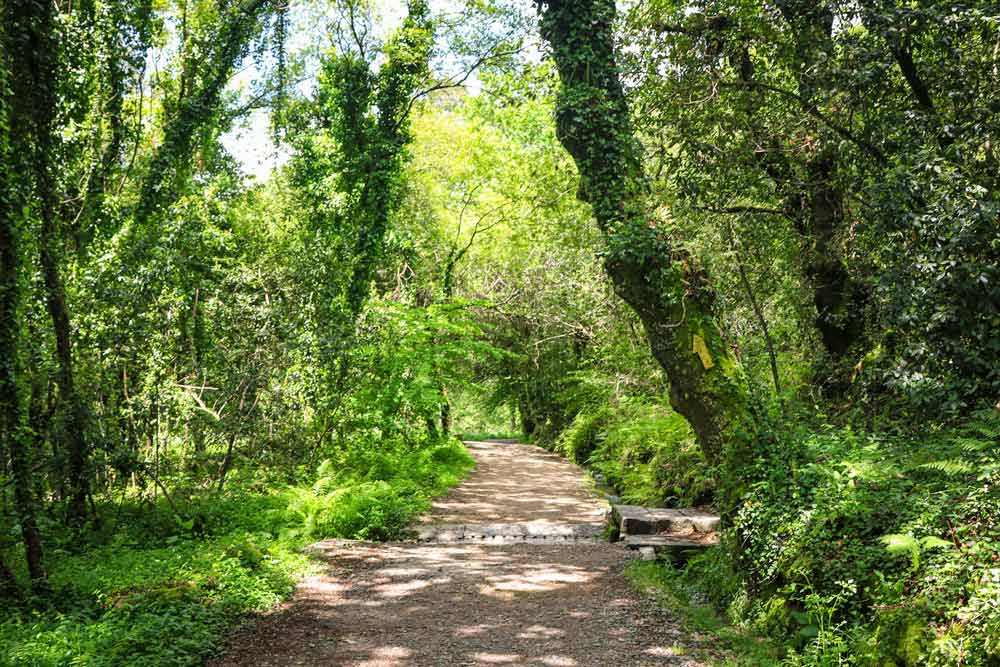
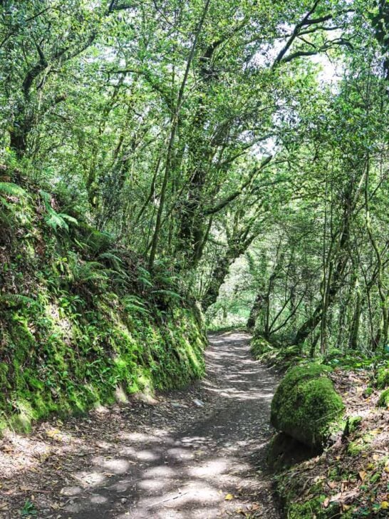
 Once on the Central Route you get to walk through the spectacular Galician forest
Stage 10. Cesantes to Pontevedra, 18 km/11 mi
- Distance – 18 km/11 mi
- Time – 5 hours (moving time)
- Ascent – 396 m
- Descent – 371 m
- Walking surface – 10.5 km/6.5 mi – tar road; 7.5 km/4.6 mi – footpath/gravel road
- Walking on the road – 0.5 km/0.3 mi
Another walking day through the forest with steep hills that you have to conquer. The hills are not as steep and long as the previous day but still can be challenging especially on a hot summer day. Always make sure to carry enough water.
Highlights
- Walking through a beautiful forest throughout the day.
- The Medieval Bridge de Pontesanpaio over the River Verdugo with spectacular views.
- The historical center of Redondela.
Challenges
- A steep ascent (around 140 m) between 3.5 km/2.1 mi and 6.5 km/4 mi
- A steep and short descent (around 100 m) between 6.5 km/4 mi and 8 km/5 mi
- Another steep ascent (around 130 m) between 12 km/7.4 mi and 14 km/8.6 mi
Route description stage 10
0.7 km/0.4 mi – a private Albergue
4.5 km/2.7 mi – Soutoxuste, a small place with a hotel, restaurant, bar, and a shop.
5.5 km/3.4 mi – Arcade, a small town with a private Albergue, hotel, restaurants, bars, shops, and an ATM.
7 km/4.3 mi – Pontesanpaio, a town with a picturesque bridge, hotels, cafes, and an ATM.
7.6-9.6 km/4.7-5.9 mi – walking through the beautiful forest.
13.5 km/8.3 mi – a bar, a shop, and a chapel where you can stamp your Credential.
13.8 km/8.5 mi – a split on the Central Route. Most people take the complementary route because it goes through the forest instead of the official route along the road.
14-17 km/8.6-10.5 mi – walking on a footpath through the forest.
18 km/11 mi – Pontevedra, a big place with a Municipal Albergue, private Albergues, hotels, restaurants, cafes, supermarkets, ATMs, and pharmacies.
Places to stay in Pontevedra
 The picturesque Medieval Bridge of Pontesanpaio
Stage 11. Pontevedra to Caldas de Reis, 21 km/13 mi
- Distance – 21 km/13 mi
- Time – 4-5 hours (moving time)
- Ascent – 275 m
- Descent – 270 m
- Walking surface – 12 km/7.4 mi – asphalt; 9 km/5.6 mi – footpath/gravel
- Walking on the road – 0 km, 1 km/0.6 mi on a footpath along the road
Today you get to walk through the beautiful forest with some hills. You will have no place to stop for food or water in the first half of the route so make sure to have breakfast and refill your water before you start walking.
Highlights
- The beautiful forest between 6 km/3.7 mi and 9 km/5.5 mi and between 16 km/10mi and 19 km/11.8 mi.
- The charming historical center of Caldas de Reis.
Challenges
- No places to stop for food/coffee for the first 9 km
- 12 km/7.4 mi walking on tar (asphalt)
Route description stage 11
0-1.4 km/0-0.8 mi – through Pontevedra.
3 km/1.8 mi – the Camino splits; the right route is the main route of the Portuguese Camino, the left route is the optional route – the Spiritual Variant.
9 km/5.5 mi – A Portela, café Pousada Peregrino.
9.5 km/5.9 mi – A Portela, a private Albergue.
9.5-10.5 km/5.9-6.5 mi – walking next to the road on a footpath.
11.5 km/7.1 mi – a vending machine and a bar.
16.5 km/10.2 mi – Briallos, Municipal Albergue (300 m from the Camino follow the signs).
18 km/11 mi – a cafe.
19.5 km/12 mi – Tivo, private Albergue/bar Vintecatro.
21 km/13 mi – Caldas de Reis, a beautiful town with private Albergues, hotels, guesthouses, supermarkets, restaurants, cafes, ATMs, and pharmacies.
Places to stay in Caldas de Reis
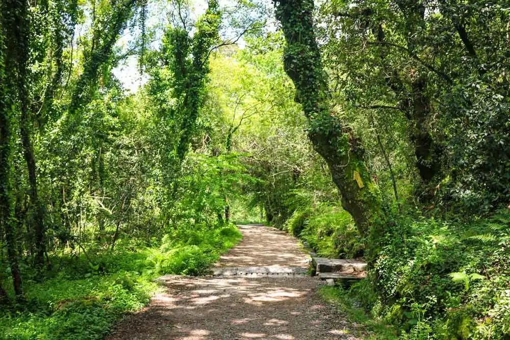
 The enchanted Galician forest on the Central Route of the Portuguese Camino
Stage 12. Caldas de Reis to Padron, 18.5 km/11.5 mi
- Distance – 18.5 km/11.5 mi
- Time – 4-5 hours (moving time)
- Ascent – 283 m
- Descent – 296 m
- Walking surface – 11 km/6.8 mi – asphalt; 7.5 km/4.6 mi – footpath/gravel
- Walking on the road – 0 km
Another day of walking through the picturesque forest and quiet countryside. Today there will be plenty of places to stop for rest, coffee, and lunch.
Highlights
- The picturesque Galician forest with small waterfalls, rivers, and rest areas.
- A beautiful church at 5.8 km/3.6 mi.
- The historical center of Padron.
Challenges
- An easy walking day on the Camino.
Route description stage 12
2-5.2 km/1.2-3.2 mi – walking through the forest.
5 km/3.1 mi – a 40-kilometers to Santiago sign.
5.4 km/3.3 mi – O Cruceiro, a bar and a guesthouse.
5.8 km/3.6 mi – the Church of Santa Mariña de Carracedo.
7.2 km/4.4 mi – a cafe.
8.5 km/5.2 mi – a bar.
9.6 km/5.9 mi – O Pino, Municipal Albergue.
9.8 km/6 mi – a rest area in the forest.
10-11.5 km/6.2-7.1 mi – walking through the forest.
12 km/7.4 mi – San Miguel de Valga, a cafe and a restaurant.
14.6 km/9 mi – a rest area.
15.5 km/9.6 mi – a drinking water fountain.
16.5 km/10.2 mi – Pontecesures, a small town with a Municipal Albergue, hotels, shops, restaurants, cafes, ATMs, and pharmacies.
18.5 km/11.5 mi – Padron, a beautiful town with a Municipal Albergue, private Albergues, hotels, supermarkets, restaurants, cafes, ATMs, and pharmacies.
Places to stay in Padron
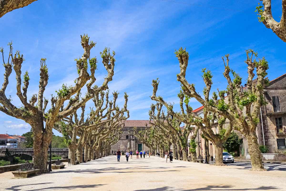 Paseo de Espolon, a park along the river in front of the Church of Santiago de Padron
Stage 13. Padron to Santiago de Compostela, 25.5 km/15.8 mi
- Distance – 25.5 km/15.8 mi
- Time – 6-7 hours (moving time)
- Ascent – 526 m
- Descent – 266 m
- Walking surface – 20.5 km/12.8 mi – asphalt; 5 km/3.1 mi – footpath/gravel
- Walking on the road – 600 m on a quiet road
Today is the longest and probably most challenging day in the suggested itinerary. There will be several ascents in the second half of the route and some not that significant descents. If you think it might be too difficult for you to walk the entire stage in one day you can split it into two: Padron to Milladoiro, 17 km/10.5 mi and Milladoiro to Santiago, 8.5 km/5.2 mi. This way you will make your last day short and arrive in Santiago in the morning.
Highlights
- The beautiful Galician forest
- The historical center of Santiago de Compostela
- Arriving at Obradoiro Square and seeing the Cathedral and hundreds of other pilgrims
Challenges
- Several ascents in the second half of the stage, the accumulated ascent for the day is over 500 m.
- Relatively long distance, over 25 km/15.5 mi
Route description stage 13
2-3 km/1.2-1.8 mi – along a busy road.
2.2 km/1.3 mi – a restaurant, a cafe.
2.7 km/1.6 mi – a hotel, a restaurant.
3-4 km/1.8-2.4 mi – walking through villages and countryside.
5.5 km/3.4 mi – Private Albergue O Logar de Jesus.
6.2 km/3.8 mi – A Esclavitude, guesthouses, a shop, a restaurant, and a bar.
8.9 km/5.5 mi – a rest area.
9 km/5.5 mi – Areal, a guesthouse.
9.5 km/5.9 mi – Picaraña, a small place with several hotels and restaurants along the route.
10-11 km / 6.2-6.8 mi – walking through the forest.
11 km/6.8 mi – O Faramello, a small place with a Municipal Albergue, private Albergue, a restaurant and a bar.
12.4 km/7.7 mi – Teo, a hotel/restaurant.
13.8 km/8.5 mi – a Cafe/shop.
14.2 km/8.8 mi – Pedreira, a private Albergue/cafe.
17.6 km/10.9 mi – O Milladoiro, a small town with a private Albergue, hotels, supermarkets, restaurants, cafes, ATMs, and pharmacies.
20.5 km/12.7 mi – a cafe/souvenir shop.
23 km/14.2 mi – a route split, both routes go to the Cathedral, the right one is a bit longer.
24 km/14.9 mi – Santiago de Compostela, a city with a Municipal Albergue, private Albergues, hotels, ATMs, supermarkets, pharmacies, restaurants, and bars.
Places to stay in Santiago de Compostela


The pretty half of Stingy Nomads, responsible for all our land adventures (hiking, climbing, walking the Camino) and following them write-ups. Alya loves walking since she was a child, she prefers to walk 1000 km with a backpack rather than to do a 10 000 km road trip (actually any road trip). Alya is a big fan of Latin America, the Spanish language, and dancing. Every time we go away she desperately misses our dog Chile.
Please visit:
Our Sponsor