
Yellowstone, the world’s first National Park, is a vast 2.2 million acre preserve with an intact ecosystem nicknamed the American Serengeti. It contains unique geological features, like a geothermal area with about 500 active geysers, prismatic pools, mud volcanoes, and travertine terraces. In fact, the enormous Yellowstone Caldera powers nearly half of the world’s active geysers and the Grand Canyon of the Yellowstone River.
Yellowstone has more than 900 miles of hiking trails and an additional 15 miles of boardwalks through the geothermal fields. Just east of Yellowstone is the Shoshone National Forest, with another 1,300 miles of trail. That’s more trail miles than the Appalachian Trail, which runs from Georgia to Maine!
This hiking guide to Yellowstone and beyond can cover every trail, but we will try to highlight the best trails for every type of hiker. Without a doubt, this list is subjective and incomplete, but we hope it contains enough information to motivate you to get off the beaten path in Yellowstone or just outside its gates.
Map of Yellowstone and Beyond
Photo Credit: Jenn Coleman.
We’ve included an interactive map with the park entrances, lodges, scenic drives, geyser fields, prominent peaks, and road junctions with native Google pins. We encourage you to click around to see crowd-sourced photographs and reviews.
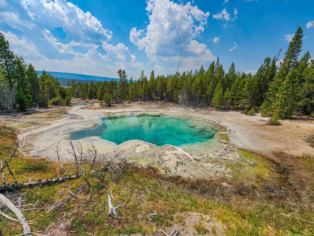
How to Use This Hiking Guide
Photo Credit: Jenn Coleman.
We have multiple levels of digital information at your disposal. First, there’s this article, but it doesn’t end there. We’ve included all the trails as line objects on our interactive map, with color-coded trail highlights that correspond to the major access road: South Loop, North Loop, Chief Joseph Scenic Byway, Beartooth Scenic Byway, Buffalo Bill Cody Scenic Byway, and the ubiquitous Hiking South of Cody. The map is interactive, so you can turn layers on and off and click around for a virtual tour.
We believe in showing our work, so we’ve included a MapMyRide route for every trail with a link embedded in the trail line object. Some were easy because they followed a trail GIS object. Others were hand-drawn from USA Topo maps augmented with satellite imagery. In general, loop hikes start and finish at the trailhead, and out-and-back hikes are only drawn one way. Be sure to double-check the mileage and accuracy before fully trusting our trail lines, but they work for introductory planning and inspiration.
We’ve also included All Trails links wherever possible.
Quick Pro-tip: get the upgrade to All Trails Pro if you haven’t already, you won’t be sorry!
One item to note is that we’ve found that these entries are crowd-sourced, so there are many areas with multiple trails that diffuse the reported trail popularity and rankings.
You might notice an East Gate/Cody-centric approach to visiting Yellowstone. Cody is a fun gateway town with delicious food and unique places to stay, and the Shoshone National Forest offers excellent hiking opportunities. It also provides an opportunity to loop together the Buffalo Bill Cody, Beartooth, and Chief Joseph Scenic Byways into a Northeast Loop that’s arguably as scenic of a drive as either the North Loop or the South Loop, but without as much park traffic.
Also, if you’re serious about hiking Yellowstone, we recommend picking up a copy of the book – The Hidden Side of Yellowstone for real local insight into area hikes.
Geyser Hikes: Observation Point
Photo Credit: Flickr.
Yellowstone has more active geysers than the rest of the world combined; that’s why we’re starting our Yellowstone hiking guide with geyser hikes. The park has several geyser fields, but the most famous and popular hikes are around Observation Point / Geyser Hill, which contains Old Faithful. Of the park’s 500 active geysers, 150 of them are located on Geyser Hill.
There are many ways to judge geysers, including eruption intervals, regularity, duration, water height, and column shape. Old Faithful has a large, regular eruption that occurs at roughly a 90-minute interval, but it’s not the tallest predictable geyser at Geyser Hill. That title belongs to Grand Geyser, the tallest such geyser in the world. Grand Geyser erupts every seven hours or so and shoots a column of water up 200′ into the air, 20′ higher than Old Faithful. The periodicity of the geysers determines the optimal route around Observation Point. Do yourself a favor and visit the Old Faithful visitor center for hiking advice.
Useful Links:
Runners Up: Mystic Falls, Lone Star
Only in Yellowstone Hike: Grand Canyon of Yellowstone (South Rim Trail)
Photo Credit: Jenn Coleman.
Yellowstone is such an enigmatic place that it’s hard to pick a “only in Yellowstone hike,” but we’ll try. We could go with something geyser-related, but we covered that in the previous section. Instead, we’ll go with the Grand Canyon of Yellowstone. The canyon is 24 miles long and around 1000′ deep with access on the north and south rim. We like the South Rim Trail because it’s a little easier to access, but there’s great hiking on both rims.
Our honorable mention in the category is Mammoth Terraces. Roughly speaking, the Yellowstone Caldera extends a few miles beyond the perimeter of the South Loop Road. Mammoth Terraces is on the northwest corner of the North Loop, far enough from the Caldera that the geothermal water bubbles up into an expansive travertine terrace instead of exploding in an erupting geyser.
Useful Links:
Best Hot Springs Hike: Hot Springs State Park
Photo Credit: Deposit Photos.
With all the geothermal activity around Yellowstone, you’d think there’d be an abundance of hot springs to bathe in. It turns out that the water’s too hot, too acidic, and too unpredictable to enter. In fact, there have been more deaths from hot springs over the years than bison and bear attacks combined. Generally speaking, visitors are prohibited from entering the park’s hot springs.
Hot Springs State Park is roughly 100 miles southeast of the caldera. That’s far enough for safety but close enough that 18,000 gallons of 135-degree water flow over colorful travertine terraces every day. There’s also a bathhouse with 104-degree water for therapeutic bathing. The park has 6.2 miles of ADA-accessible trail and hiking trails, including a pedestrian suspension bridge over the Bighorn River and the Rainbow Terraces Trail.
The honorable mention “hot springs” are the Boiling River Hot Springs and Firehole River Swimming Area. Currently, Boiling River access is suspended because of damage from the 2022 flood. However, you can still access the Firehole Swim Area on the Firehole River, two miles south of Madison Junction on Firehole Canyon Drive.
Swimming Hole Hikes: Shoshone Lake
Photo Credit: Deposit Photos.
The Delacy Creek Trail is a relatively flat (< 300′ gain) 6.3 mile out and back route to Shoshone Lake. The level ground makes for brisk hiking, followed by a brisk dip in a mountain lake at 8000′ elevation. The delta from Delacy Creek forms a natural swimming beach as it reaches Shoshone Lake.
Heart Lake is our runner-up in this category, with access by a 15-mile out-and-back on the Heart Lake Trail. It’s a longer hike, but the solitude is great for camping and fishing. In fact, a park record 42-lb lake trout was caught in Heart Lake! There are five backcountry camps spaced along the shoreline here.
Best Waterfall Hikes: Fairy Falls
Photo Credit: Flickr.
Fairy Falls isn’t the most impressive waterfall in Yellowstone, but the combination of loop trails, Grand Prismatic Spring views, and geysers makes it our choice for the best waterfall hike. The basic trail is a 5 mile out-and-back, but you can make it to Imperial Geyser with a 6.7 mile out-and-back, or you can make it an 8.8-mile loop hike.
Runners up in the waterfall hike category are the Tower Falls Trail because it’s easy and Osprey Falls because it’s hard. You could reach Osprey Falls with a 9-mile out-and-back, but if you have the gumption, consider making it a loop by going up and over Bunsen Peak.
Best Wildlife Hikes: Lamar Valley
Photo Credit: Jenn Coleman.
The Yellowstone area is known as the American Serengeti because of the abundance of wildlife. It’s not uncommon to see bison, bighorn sheep, and antelope, even if all you’re doing is driving on the park roads. Of course, there are safety rules for these big animals, like staying at least 100 yards away from bears and wolves and at least 25 yards away from all other animals, including bison and elk, and don’t ever feed wildlife. Also, while we’re at it, never park in the road or block traffic. Grand Loop traffic jams are one good reason why it’s nice to get a big lens or binoculars and head out on foot for watchable wildlife.
The Lamar Valley Trail following the Lamar River is a wildlife hotspot, but Eagle Creek and Grinnell Meadows are close behind. These are all out-and-back trails along high mountain rivers and streams, so you can hike as little or as much as you desire.
Best Wildflower Hike – Slough Creek
Photo Credit: Flickr.
There’s an algorithm for finding the best wildflower hike in Yellowstone. Look for an area that burned 2-5 years prior, and go there. The flowers will be soaking in the extra sunlight and loving life. The Forest Service maintains a Yellowstone Wildflower page with prominent species, their corresponding blooming season, and their general location. It also shares this gem: “The most conspicuous wildflower displays occur in open meadows and sagebrush-steppe.” Which, coincidently, is prime country for watchable wildlife as well.
We have Slough Creek Trail as our top wildflower hike, with Cascade Lake Trail and Pebble Creek Trail as runners-up. In many ways, wildflower hikes and wildlife hikes are somewhat interchangeable. You just leave earlier in the morning or later in the afternoon for wildlife and bring a different lens for your camera. Slough Creek is an out-and-back, so you can pick your hiking distance. You’ll want to reach Cascade Lake, which makes it a 6-mile hike. Pebble Creek Trail is 12 miles point-to-point to connect back to the Beartooth Byway. If you don’t want to set up a shuttle or hike a 24-mile day, I would start on the southern trailhead and hike an out-and-back heading north so you can maximize your time along the creek.
Best Loop Hike: Beartooth Lake
Photo Credit: Flickr.
If you’re confident in how far you can hike, a loop hike is a great way to see the most new things without doubling back or setting up a shuttle. That’s the secret sauce of loop hikes and why there’s a section dedicated to them. Our choice for this category is the Beauty Lake and Beartooth High Lakes Loop, a 7.6-mile loop through high country lakes. If you want to try its more rugged twin, there’s the 11-mile Beartooth Lake Loop via the Gardner Lake Trail just a few miles away.
If you want something easier, the 2.5-mile Storm Point Loop offers sweeping views of the 136 mi² Yellowstone Lake, and the 1.2-mile Trout Lake Loop takes you all the way around the much smaller Trout Lake.
Best Views: Mt Washburn
Photo Credit: Flickr.
Good views are often synonymous with peak bagging, a sport unto itself. Ed Viesturs famously said, “Getting to the top is optional. Getting down is mandatory.” That’s why we selectedDunraven Pass to Mount Washburn (6.8 mi, 1400′ gain) as our choice for the best views. It’s right off the North Loop and well-traveled, so you shouldn’t have any surprises. There’s also a road to the top in case things get too funky.
Other choices include:
Best Bridge Hike: Hellroaring Creek
Photo Credit: Flickr.
If the Forest Service put out a calendar of Bridges in the Wilderness, I would give it to at least half my Christmas list. They do a fabulous job of constructing bridges in the middle of nowhere with arduous stories of all the building material being carried in by mules.
The Hellroaring Creek Trail to Yellowstone River has one such bridge, which crosses over the Yellowstone River one mile into the hike. If you have the legs, consider continuing on till you reach Hellroaring Creek and follow it to the confluence with the Yellowstone River. This will be about a 7-mile hike, and you can make it a lollipop loop if you come back on the other side of the creek.
Yellowstone also has natural bridges that are worth visiting. Yellowstone Natural Bridge Trail is a straightforward 3.1 mile if you can find your way out of the marina. The Blackwater Natural Bridge is one of the largest in the world, but the hike is anything but straightforward. You approach following the Post Point Historical Monument Via Blackwater Trail but instead of turning off to Post Point, you continue down the Blackwater Trail. It’s a brutal 11-mile out-and-back hike with over 3,200′ of elevation gain to catch a glimpse of the massive Blackwater Natural Bridge.
Best Historic Hike – Brown Bear Basin Trail (Kirwin)
Photo Credit: Visit Cody Yellowstone.
Yellowstone is full of history, from the rare geological record to modern devastating wildfires. However, two events particularly capture our imagination. The first is Kirwin, a ghost town abandoned in the early 1900s. It was too remote with too many avalanches to settle, but many of the buildings are more or less intact, including Amelia Earhart’s cabin. Several trails lead out of town, including the Brown Bear Basin Trail and the Bald Mountain Trail. There are even tours from Meeteetse if you want an interpretive guide or to have somebody else’s vehicle grind up the mountain roads.
The second historic event is the flight of the Nez Perce. In 1877, five years after Yellowstone became a National Park, Chief Joseph led a band of 800 men, women, and children and about 2,000 horses from their homeland in Oregon. They spent 13 days eluding the army as they traveled through the park and over the Absaroka Mountains into Montana. Chief Joseph chose the Dead Indian Creek route to avoid Col. Sturgis’ trap at Dead Indian Pass. With this tactic, they gained a two-day advantage over their pursuers, but their 1,170-mile journey ended 40 miles short of the Canadian border and potential freedom. Chief Joseph gave his famous surrender – “I will fight no more forever,” and the survivors were relegated to life on a reservation in the Oklahoma Territory.
Other Notable Hikes
Photo Credit: Flickr.
Even though we’re about 3,000 words into this guide, we’ve barely touched Yellowstone’s hiking potential. Here are a few notable hikes that we couldn’t slip in elsewhere but are worth mentioning.
- Copper Lakes Trail: A long off-road approach leads you to a steep and overgrown trail. It’s not everyone’s idea of a good time, but this is the kind of hike that nourishes the adventure lover’s soul.
- Grizzly Lake Trail: A popular out-and-back trail to a quiet alpine lake with lots of wildlife potential.
- Meadow Creek Basin: If you have extra time on your Kirwin adventure, consider hiking Meadow Creek Basin.
Parting Thoughts
Photo Credit: Jenn Coleman.
We hope you’ve been entertained and inspired, but we would like to take a moment to talk about safety. We’ve already covered animal and geothermal safety, and of course, please follow the usual hiking tips for bear country and lightning. Also, don’t forget to double-check all trail information we’ve provided with relevant sources (like park rangers) before venturing out. Also, make sure you are packed for a day hike or prepared for a multi-day hike.
Pro-Tip: If you are looking to see and learn a lot about Yellowstone in a short amount of time? Consider booking a day tour with CoveredGround Tours.
We’d also be remiss if we didn’t mention the winter road conditions. The only park road open to year-round travel is from the North Entrance through the park to Cooke City via Tower Junction. The other roads are only open to commercially-guided snowmobiles and snow coaches from mid-December to mid-March.
Outside the park, the Beartooth Highway (US-212) is generally open from the Friday of Memorial Day weekend to mid-October. The Chief Joseph Scenic Byway from Cooke City to Pilot Creek is typically open from mid-May through early November.
Disclosure: A big thank you to Cody/Yellowstone for hosting us and setting up a fantastic itinerary!
For more Cody/Yellowstone travel inspiration, check out their Instagram, Facebook, X, and YouTube accounts.
As always, the views and opinions expressed are entirely our own, and we only recommend brands and destinations that we 100% stand behind.
Hi! We are Jenn and Ed Coleman aka Coleman Concierge. In a nutshell, we are a Huntsville-based Gen X couple sharing our stories of amazing adventures through activity-driven transformational and experiential travel.
Please visit:
Our Sponsor